


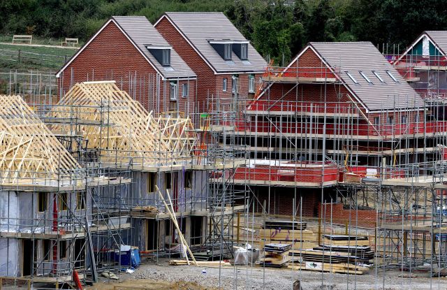
Construction in the Green Belt. Credit: Gareth Fuller/PA Wire


Forgive the lurid headline, but it is kind of true.
Let’s begin with some hard evidence, as reported on by Fergus O’Sullivan for CityLab:
“Living in a more densely built area significantly lowers your risk of obesity. Such is the unavoidable conclusion of a new survey of British cities that compares obesity rates with housing density. The study, carried out by specialists at the universities of Oxford and Hong Kong, found that obesity rates were markedly lower in areas where homes were more tightly clustered.
“This might not come as a shock, given the long touted health benefits of walkable neighborhoods. What makes the study, published in medical journal The Lancet and first covered by Reuters, truly groundbreaking is its sheer scale, collating data for over 419,000 respondents in 22 British metropolitan areas over a period of four years.”
Making appropriate comparisons between people of the same age and sex, the fattest people are to be found in the suburbs:
“The worst obesity rates, the study finds, are among British people who live in areas with 1,800 homes per square kilometer (around 4,662 dwellings per square mile). That’s close to the typical density for London’s more sprawling, low-density outer boroughs…”
At even lower densities, i.e. more rural areas, obesity rates were somewhat lower – but other than that there is negative relationship between density (of housing) and obesity (of people).
Why the association between sprawling suburbs and sprawling waistlines?
“The obvious answer is walkability. When amenities are within easy walking distance there is, quite simply, more incentive to walk to them, while densely built environments can also de-incentivize driving because of their congestion and limited parking.”
Sprawl and obesity are linked in another way, too. Using too much land and eating too much food are both sins of carelessness. Unconstrained by planning laws or dietary discipline, spreading out is an easy habit to slip into.
The blubbery growth of London’s outer suburbs is precisely why the UK has such a restrictive planning system. Britain built a lot of houses during the interwar period (indeed the private sector has never built more than it did in the 1930s). However, quantity came at the expense of quality. The architecture was less attractive than in preceding decades and the workmanship shoddier. On the macro scale, planning was often non-existent, with so-called ‘ribbon development’ – i.e. building along main roads with no thought for future transportation needs – becoming standard practice. London and other cities blocked their arteries in the process. We live with the consequences to this day, unable to widen key routes or provide more housing within a reasonable distance of city centres.
It is no wonder that the state intervened – by throwing up a hard barrier to further sprawl in the shape of the metropolitan green belt (and similar zones around other built-up areas). Today the green belt provides a convenient scapegoat for the housing crisis. Abolish it and the market will provide the houses we need, say the lobbyists. History and the present-day experience of other countries show that what we’d get instead are ‘outer outer’ suburbs. This is what Americans call ‘exurban’ development – a supremely car-dependent, obesogenic environment that chews up land without fitting that many more people onto it (and not just because so many of them are overweight).
Morbid suburbia is not the way forward. If we want to free up parts of the green belt, it must be to found densely-built, architecturally beautiful, walkable communities – and that will require more planning not less.
Peter Franklin is Associate Editor of UnHerd. He was previously a policy advisor and speechwriter on environmental and social issues.
 peterfranklin_
Join the discussion
Join like minded readers that support our journalism by becoming a paid subscriber
To join the discussion in the comments, become a paid subscriber.
Join like minded readers that support our journalism, read unlimited articles and enjoy other subscriber-only benefits.
Subscribe